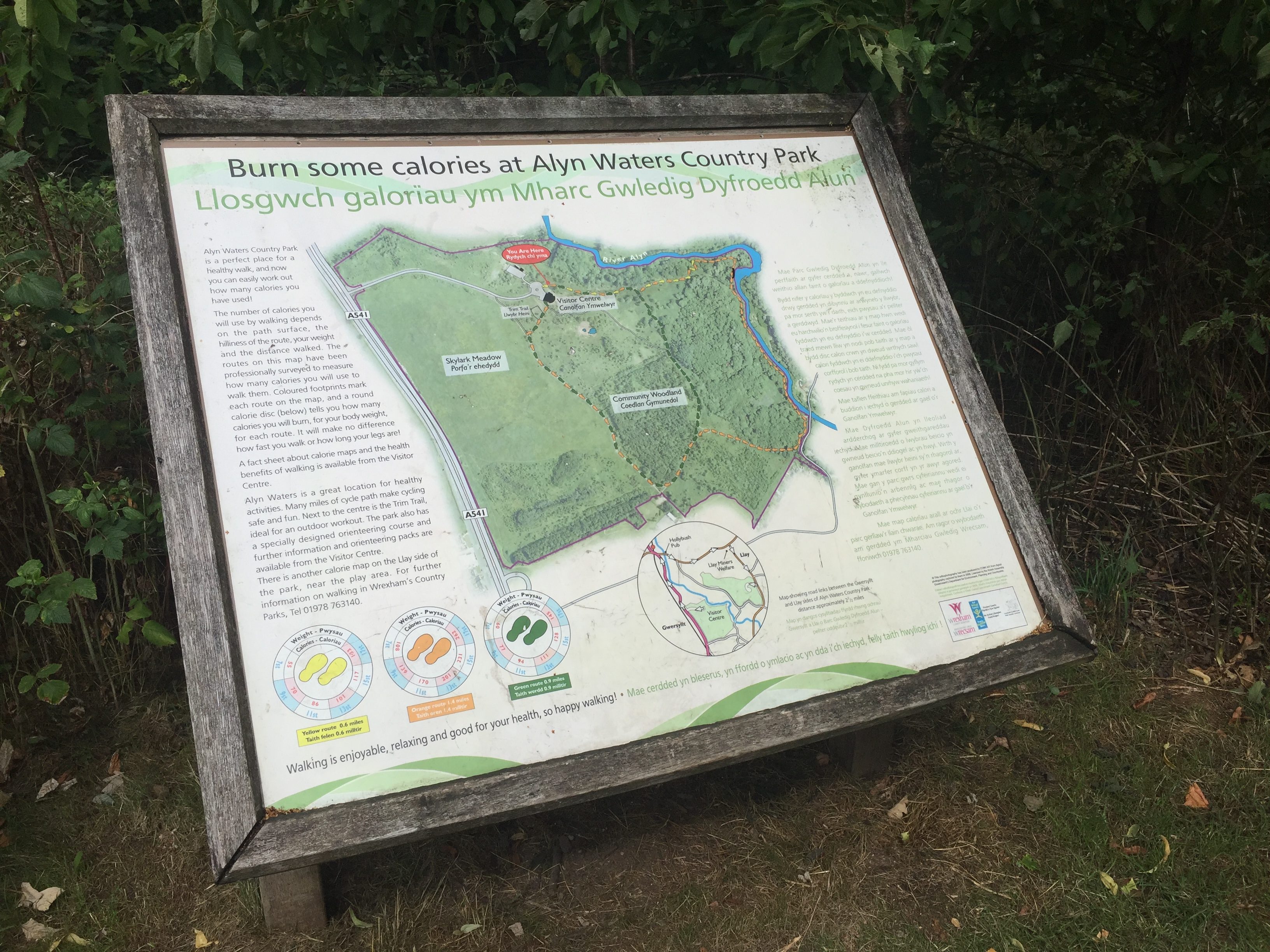
Many of us are trying to get a bit fitter and healthier in 2019…
And a lot of you are probably thinking about the calories you’re burning to help you reach your goals.
There are a few different methods of doing this, but they’re often quite expensive.
But you don’t necessarily have to pay-out money to track this…
Did you know a number of walking routes at Alyn Waters and Tŷ Mawr Country Park have been professionally surveyed to let you know how many calories you burn along the way?
Well they have, and there’s a great leaflet you can download from our website that gives you more detailed information.
Coloured footprints mark each route on the maps, and a round calorie disc tells you how many calories you’ll burn, for your body weight, for each route. It doesn’t make a difference how fast you walk or how long your legs are 😉
So, what are the routes? Here’s a brief outline…
Alyn Waters
From the Gwersyllt side of Alyn Waters, there are three routes…yellow (0.6 miles), orange (1.4 miles), and green (0.9 miles).
These routes all start from the car park in front of the Visitor Centre, and are waymarked with coloured footprints carved onto wooden posts.
Or, if you’re coming into Alyn Waters from the Llay side, there’s a blue (0.7 miles), red (1.6 miles), and purple route (1.8 miles).
Here’s a video from our walk at Alyn Waters last year:
Tŷ Mawr
At Tŷ Mawr, you have two routes to choose from…there’s the yellow Tŷ Mawr trail (0.9 miles), or there’s the longer red Aqueduct trail (2.6 miles). Both of these start from the Visitor Centre.
Here’s a video from our walk at Tŷ Mawr last year:
That should be enough information to get you up and running…or should we say walking 😉
We’ll see you there!
Welsh speaker? Help us improve our Welsh language services.
[button color=”” size=”large” type=”square_outlined” target=”new” link=” http://www.yourvoicewrexham.net/KMS/elab.aspx?noip=1&CampaignId=803&SessionId=7W3XW8KTF6″] COMPLETE THE SURVEY NOW [/button]


